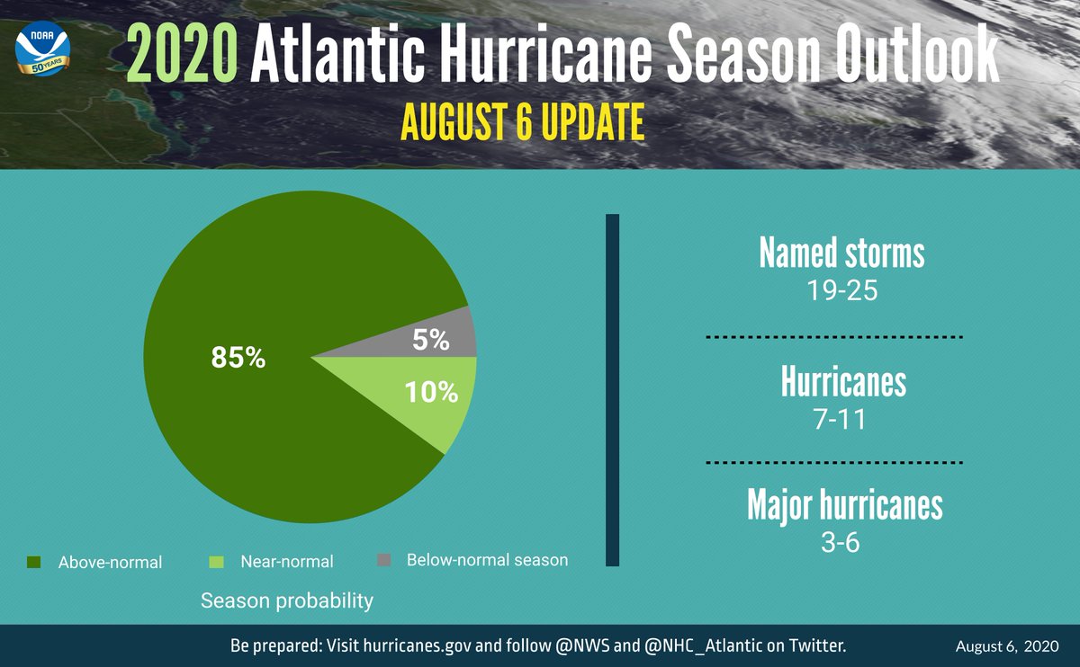
This is my final forecast for the 2020 #Atlantic #Hurricane Season:
Named Storms: 22-26 (Avg: 12)
Hurricanes: 10-12 (Avg: 6)
Majors (C3+): 5-6 (Avg: 3)
ACE: 180-220 (Avg: 100)
There's lots of factors in place for a continued very busy season, so let's go through them...
Named Storms: 22-26 (Avg: 12)
Hurricanes: 10-12 (Avg: 6)
Majors (C3+): 5-6 (Avg: 3)
ACE: 180-220 (Avg: 100)
There's lots of factors in place for a continued very busy season, so let's go through them...
Let's first recognize that this season so far has been extremely active. We've seen 10 TCs, 9 of which (a record to date) have become tropical storms, and 2 became hurricanes. ACE has also been 230% of normal. These are included in my unofficial forecast...
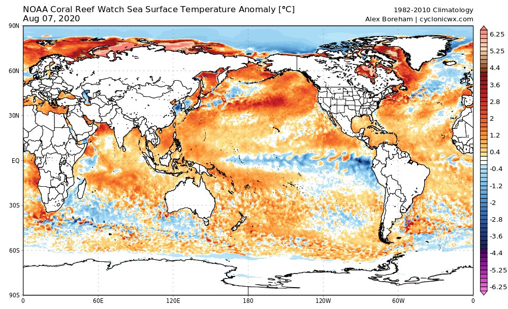
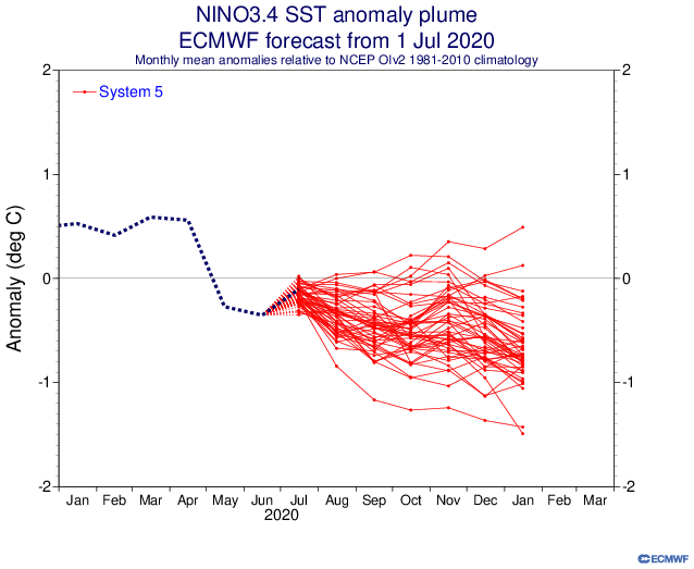
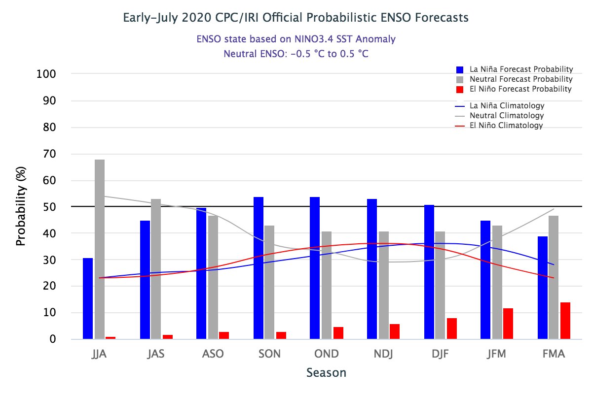
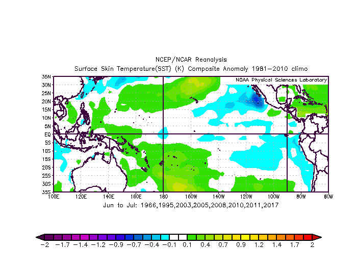
The ENSO state right now is cool-based neutral. There's currently a La Nina Watch in place, as this will likely develop into a full-fledged La Nina this fall. This is coupled with a -PDO pattern, though nontraditional. Both of these support ATL hurricane activity...
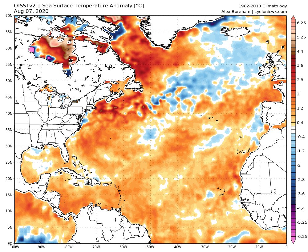
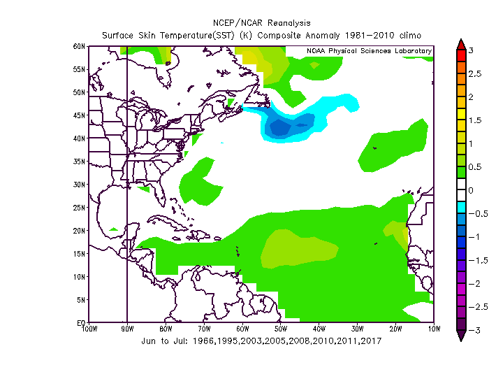
The Atlantic SSTA configuration is also favorable, as MDR SSTAs are the 4th highest on record. While not a traditional 1st EOF AMO or positive tripole pattern, as there is some anomalous subtropical warming, this pattern is directly correlated to high hurricane activity...
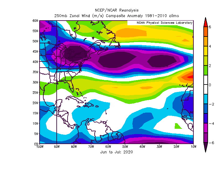
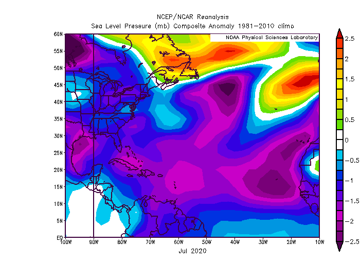
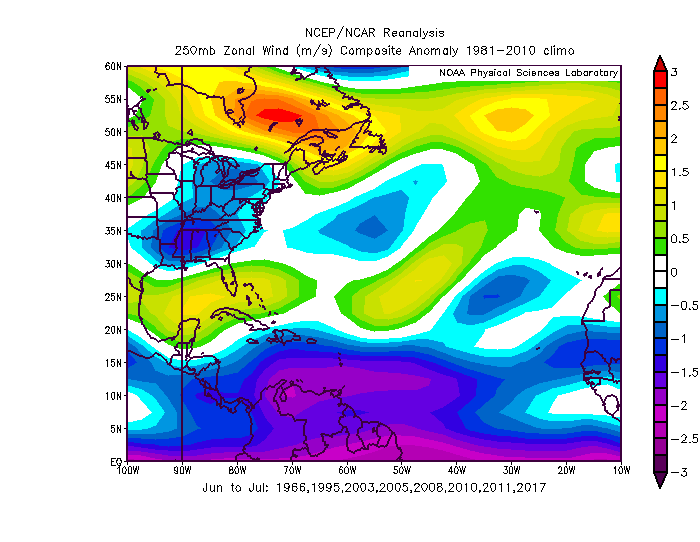
Wind shear across the tropics has been anomalously low, likely due to few TUTTs and minimal EPAC activity. Sea level pressure anomalies across the tropics were the lowest ever observed during July, which is usually observed with high instability and lower wind shear...
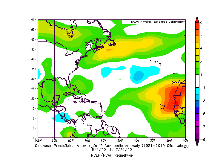
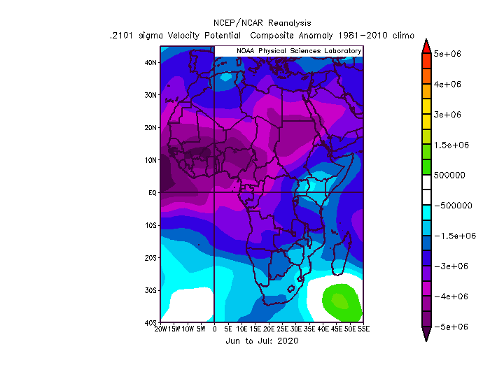
The West African Monsoon continues to be strong, with high PWAT anomalies boosted by an African Standing Wave and will continue to promote ascent. While this has resulted in Saharan dust outbreaks over the basin, this has created an overall wetter than normal pattern...
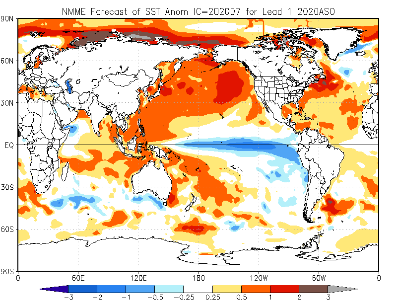
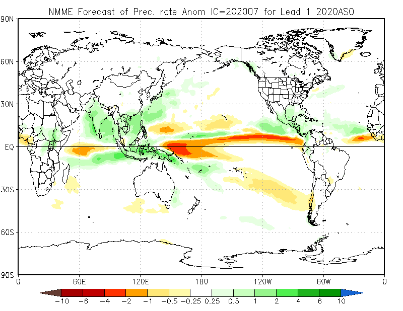
Climate models also depict a concerning picture. The NMME forecasts continued cooling in the ENSO along with a warm ATL and high precip anomalies. Even dry biased models, like the ECMWF long range, suggest a busy season is ahead...
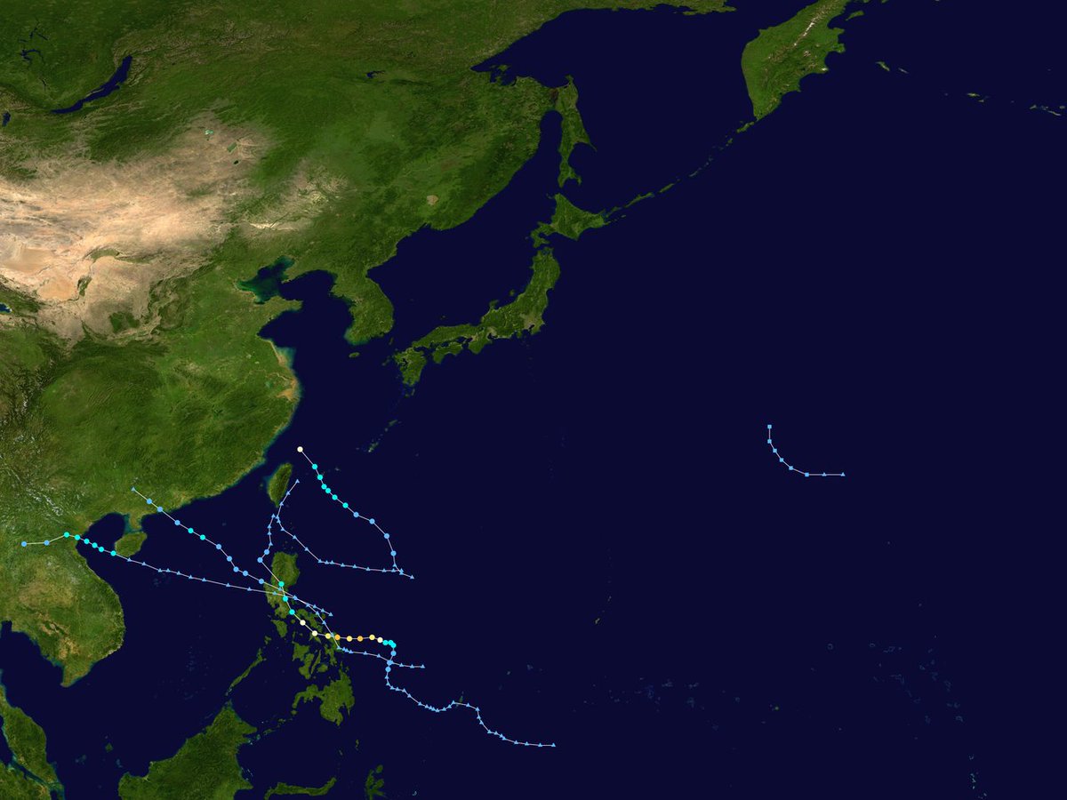
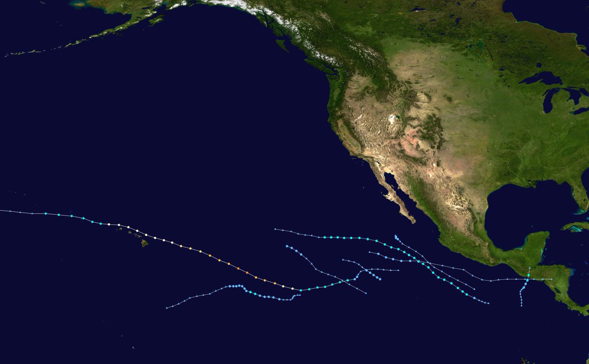
The Pacific, whose activity is inversely proportional to the ATL, has been very quiet. The WPAC has only had 4 storms, 2 typhoons, and 13% of normal ACE, and the EPAC has had weak, short-lived storms besides Douglas so far. This is due to the ASW promoting sinking here...
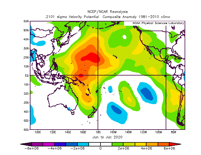
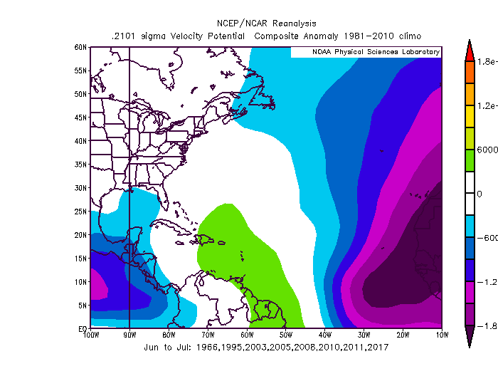
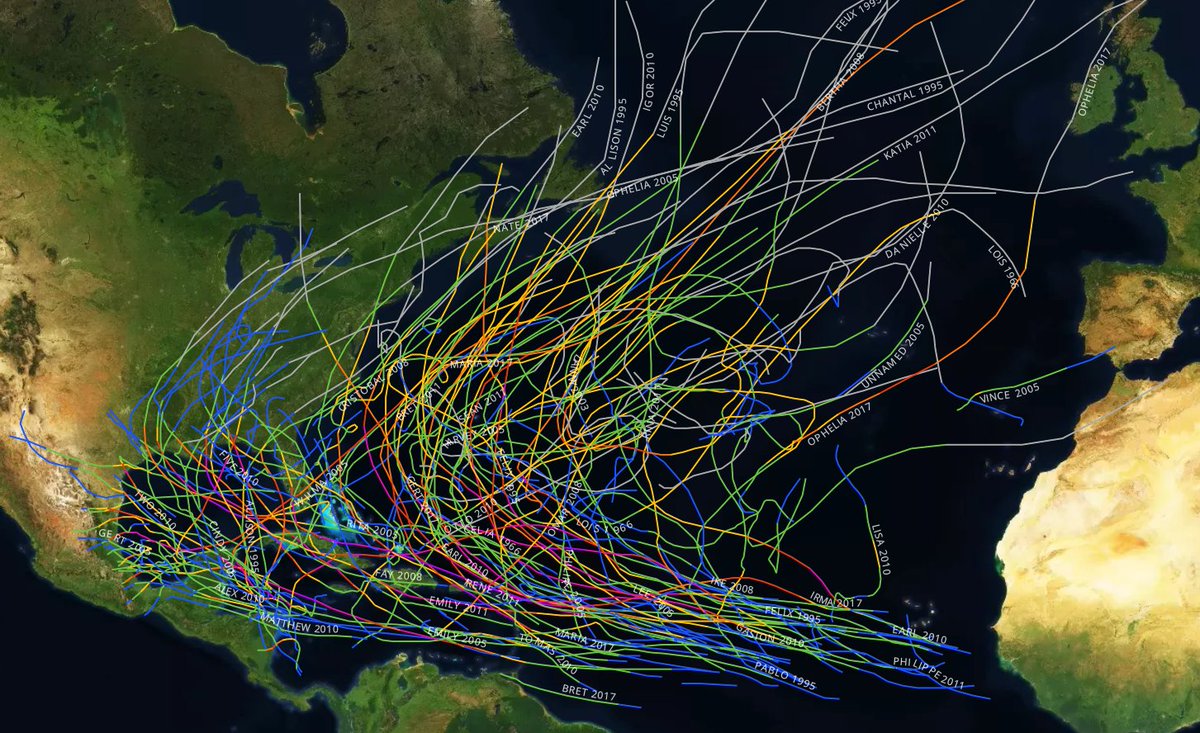
Using analogs give a decent idea of what may be coming. The best analogs for 2020 are 1966, 1995, 2003, 2005, 2008, 2010, 2011, and 2017. This set averaged 17 NS, 10 HUs, 5 MHs, and 183 ACE points. All composites below (ENSO, ATL SSTAs, 250mb ZW, and VP200) are similar to 2020...
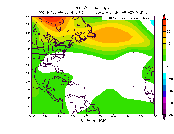
All 8 of these years also high impact years and averaged 5 landfalling hurricanes. Years like 2010 and 1995 had lots of recurves, but this year, the subtropical ridging is abnormally strong, which may result in more Caribbean and US impacts from Cabo Verde storms...
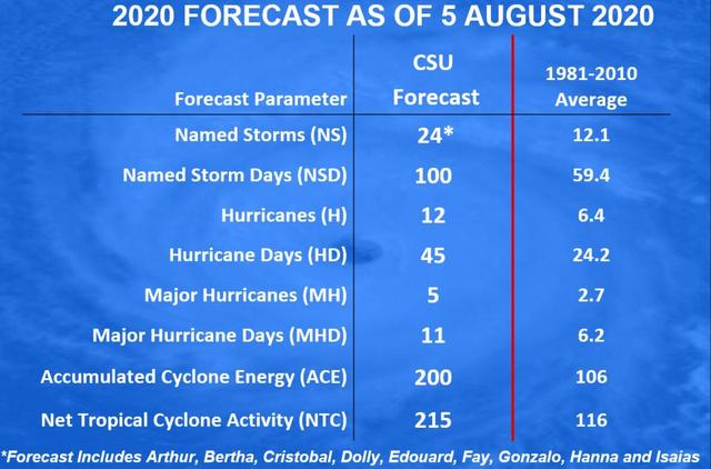
Other forecasting agencies, such as NOAA and CSU, are also predicting a high impact year, with everything listed above provided as evidence. While this is concerning, this is the time to complete preparations just in case a hurricane comes your way this year...
The added element of COVID-19 this year will make planning and logistics extra difficult, so please keep CDC guidelines in mind during this time. Controlling the spread is crucial, especially in a hurricane. Here's a guide from the CDC: https://www.cdc.gov/disasters/hurricanes/covid-19/prepare-for-hurricane.html
NOTE: I am not a meteorologist, just a weather enthusiast and meteorology major. My forecast is not an official source, so please do not use it as such.
Please use official sources, such as the NHC and your local NWS office to make decisions. Stay safe everyone!
Please use official sources, such as the NHC and your local NWS office to make decisions. Stay safe everyone!

 Read on Twitter
