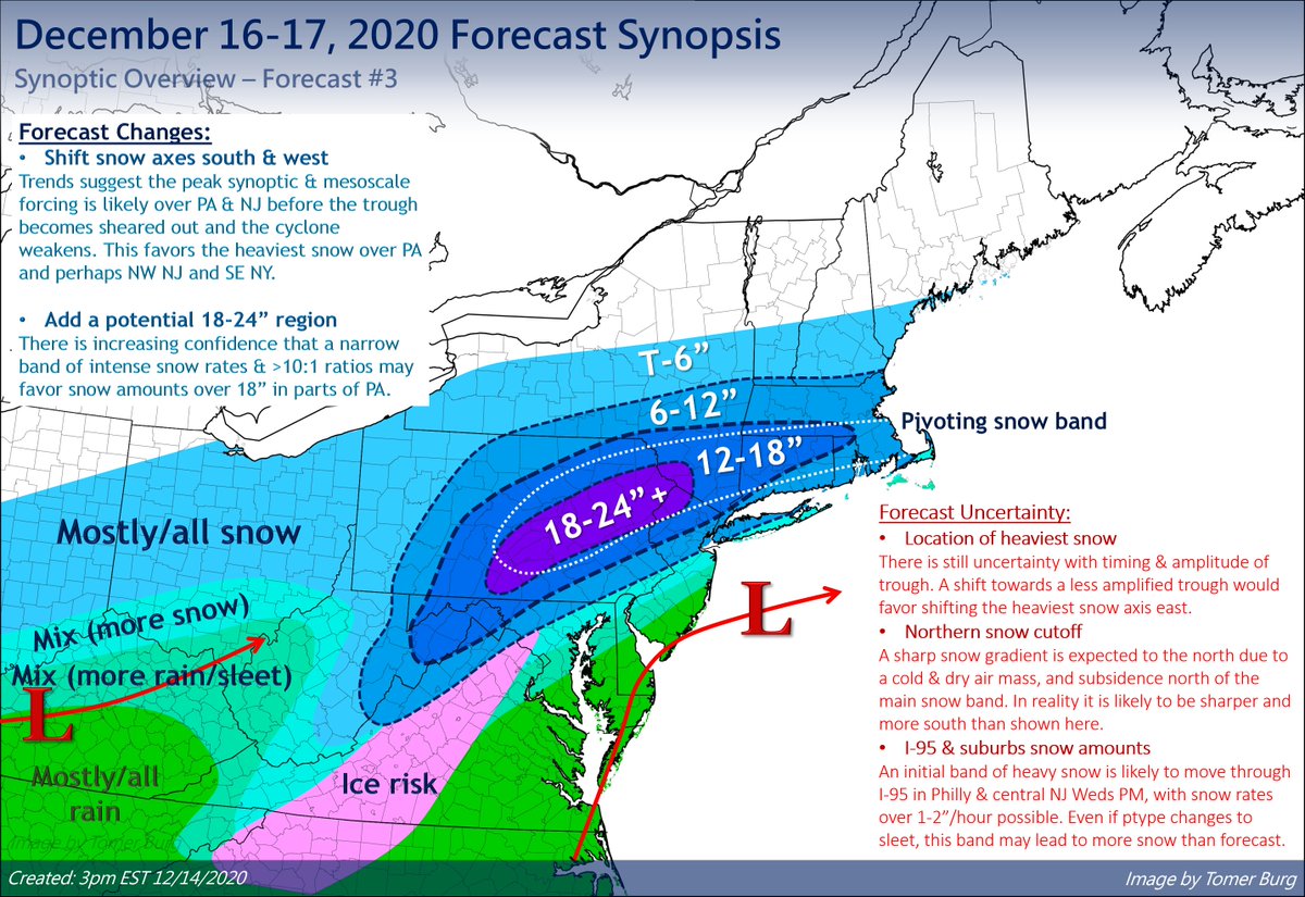
Today's forecast update for Wed/Thu:
I shifted the snow axis south and west vs. the last forecast, as I'll elaborate more in subsequent tweets. Some uncertainty remains, but confidence is increasing in the heaviest snowfall over central/NE PA where as much as 2' is possible. https://twitter.com/burgwx/status/1338190425132322821
I shifted the snow axis south and west vs. the last forecast, as I'll elaborate more in subsequent tweets. Some uncertainty remains, but confidence is increasing in the heaviest snowfall over central/NE PA where as much as 2' is possible. https://twitter.com/burgwx/status/1338190425132322821
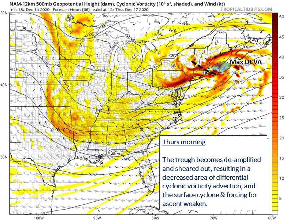
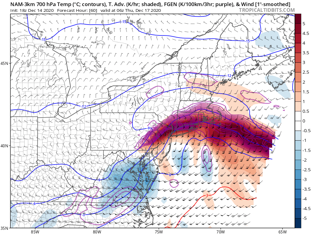
My biggest forecast change was moving the max snow SW into PA. The strongest forcing associated with the trough is forecast in PA & NJ, favoring a deepening cyclone & strong fgen banding. The s/w deamplifies farther east, favoring a weakening cyclone and less precip by Thu AM.
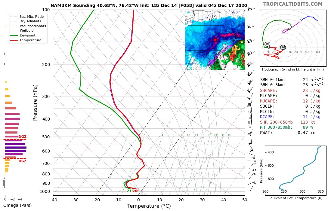
Strong mid-level fgen due to strong WAA & conv will be associated w/ intense snow band, initially traversing SW-NE through PA & NJ before pivoting (likely from C PA to SE NY to CT/MA). Given ample moisture & strong ascent collocated in a saturated DGZ, >3"/hour rates are psbl.
This is a fairly fast moving event, with the heaviest snow likely confined to about a 12-hour window. As previously noted, PA has the combo of strongest synoptic forcing (longest duration snow), pivoting band & >10:1 ratios, favoring as much as 18-24" of snow if not more.
Elaborating on the uncertainties a bit more:
- Even if central NJ & Philly likely change to sleet, more intense snow rates w/ initial snow band than fcst will increase total snowfall.
- The north cutoff is likely to be quite sharp. This will likely need to be adjusted south.
- Even if central NJ & Philly likely change to sleet, more intense snow rates w/ initial snow band than fcst will increase total snowfall.
- The north cutoff is likely to be quite sharp. This will likely need to be adjusted south.

 Read on Twitter


