I’m excited to share this preprint for a new method of generating hemispherical photos from smartphones to estimate forest canopy measures. The results are even better than DSLRs, as I explain in this thread. 1/n
#forestry #ecology https://www.biorxiv.org/content/10.1101/2020.12.15.422956v1
#forestry #ecology https://www.biorxiv.org/content/10.1101/2020.12.15.422956v1
Here is a longer blog post I wrote about this study with more detailed instructions. TL;DR version to follow. 2/n http://www.azandisresearch.com/2020/12/16/smartphone-hemispherical-photography/
Traditionally, hemi photos required super expensive DSLR cameras, special lenses, and a levelling device. Taking photos and getting proper exposure was tedious. And most estimates were wrong bc of bad exposure settings. 3/n https://iforest.sisef.org/contents/?id=ifor0957-006
Meanwhile, we are all walking around with lightweight, high-performance image processing machines in our pockets in the form of smartphones. I realized that we can exploit a common feature of phones for easier & better hemi photos... 4/n
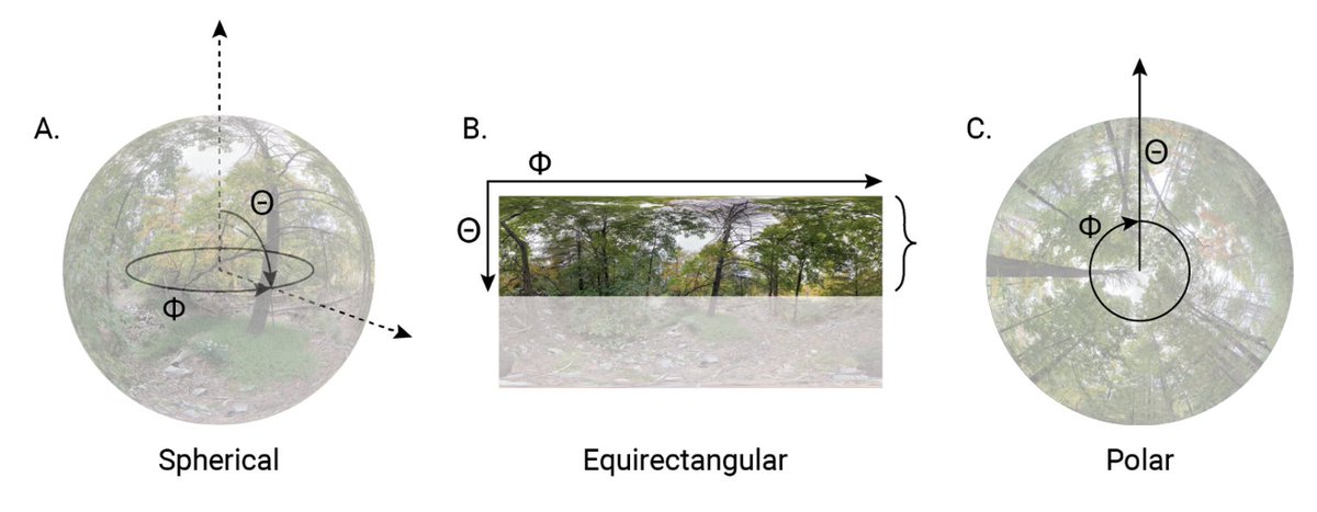
All modern smartphones can capture 360° photo spheres. It is really simple. The phone guides you through the entire process. 5/n
The photo spheres are saved as 2D projections (like a world map). I realized that if you extract the upper half of the image and remap it onto polar coordinates, you get a hemispherical image with perfect polar projection. 6/n
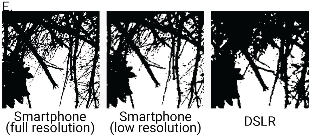
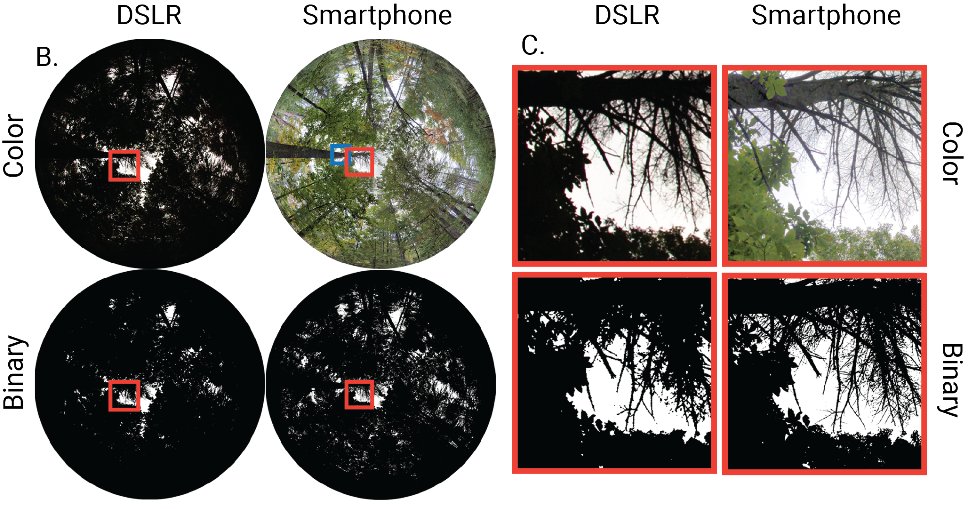
Plus the phone hemi photo has much higher resolution because, unlike DSLRs, the phone image is stitched together from many images. This means it retains more detailed canopy structure = better estimate (even when downsampled to comparable resolution). 7/n
Another benefit is that phones use computational photography techniques that produce super sharp images with high dynamic range. So, the image is not only larger, it is better quality overall. 8/n https://www.nytimes.com/2019/10/15/technology/personaltech/google-pixel-photography.html
It also means that the resulting hemi photo is evenly exposed across the image, so there is no need to fiddle with exposure settings, making estimates far more robust and accurate. 9/n
Not to mention, the phone uses its internal gyroscope to automatically level the image. So, there is no need for fancy lenses or self-leveling devices. Plus, geo location, elevation, and compass orientation are all stored in the image metadata. 10/n
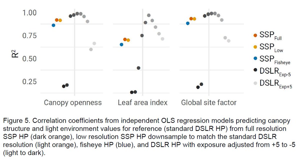
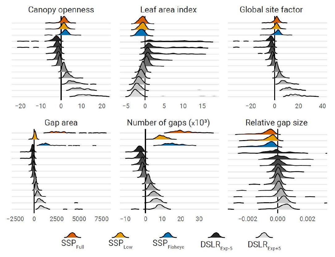
Compared to traditional methods, smartphone photos perform really well. Correlation between methods is > 0.9 for CO and GSF. 11/n
The difference in estimates is mainly due to the phone OUT-PERFORMING the DSLR reference images due to higher resolution and detail. 12/n
This method is so easy. It opens hemi photo methods up to non-experts making large scale volunteer projects possible.
And there are a million other possibilities for using smartphones spheres in science!
Please share!
THE END
And there are a million other possibilities for using smartphones spheres in science!
Please share!
THE END

 Read on Twitter